| Home | | |
About | | |
Senators | | |
Committees
| | |
Secretariat | | |
Legislative Documents
|
| |
Publications
|
| | | | Bagong Senado |
| Home | | |
About | | |
Senators | | |
Committees
| | |
Secretariat | | |
Legislative Documents
|
| |
Publications
|
| | | | Bagong Senado |
|
Photo Release
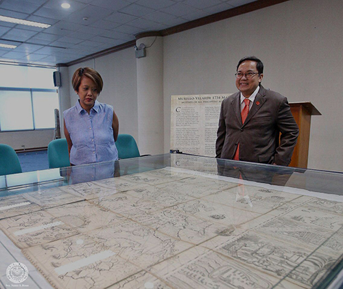
HOLY GRAIL OF PHILIPPINE MAPS: Senator Nancy Binay observes the 1734 Murillo Verlarde Map, regarded by historians as the first scientific map of the Philippines as it shows the inclusion of the Spratly islands and the Scarborough Shoal to the country's territory. It serves as the historical basis for the Philippines claim over the islands in the South China Sea. In 2014, the map was auctioned at Sotheby's and was acquired by Filipino entrepreneur Mel Velasco Velarde. Mr. Velarde has already donated the map to the Filipino people and will be displayed at the National Museum. It will be officially turned over to President Rodrigo R. Duterte on the celebration of Independence Day 2017. |
Photos
|
| © Senate of the Philippines. All rights reserved. |
Job Openings |
Contact Info | RSS Feeds
 | Search | Site Map | Search | Site Map |